Tuesday, June 21, 2016

The Places of interest in Kishoreganj

Kishorganj is a place of the creed of respectively Sanatana and Loukik Islam. Both Meghna and Brahmaputra river have contributed to its existence. Many traditional rituals are observed every year in Kishoreganj. Among them Kurikhai Mela is one of the most celebrated fair. It is a shrine-oriented festival. It is held every year on the last Monday of the month of Magh. The shrine is situated in Katiadi thana. The notable Shamsuddin Aulia, one of the fellow of Hajrat Shahjalal, died in this particular place.

Jangalbari Fort

Jangalbari Fort is situated in Jangalbari village of Karimganj Upazila. It was once a strong outpost of the Bengal Ruler Isa Khan. Isa Khan erected several structures inside the fort area. This fort was severely damaged by the great earthquake in 1897.Isa Khan's descendants still live in this village. Currently the fourteenth descendant of Isa Khan, Dewan Amin Dau Khan, lives in the fort.

Egarosindur

Egarosindur (Bengali: এগারসিন্ধুর) is a village in Kishoreganj. The village is situated on the east side of the river Brahmaputra. The name of this village is found in the Akbornama by the historian Abul Fazal. There is a debate among historians about the history of Egarosindur. Some engraved silver coins, iron-axes, lances and bows and arrows were discovered there presumed to be from the 10th century BC. Historians also believe that Egarosindur was inhabited since 1000 BC, i.e. the time of the Murza. There lived many tribals named Koch and Hajong. Egarosindur was a centre of trade and commerce.

Shah Mahmud Mosque

It is an attractive building at Egarosindur may be dated sometime around 1680AD. The mosque stands at the back of a slightly raised platform,which is enclosed by a low wall with a gateway consists of an oblong structure with do-chala roof. The mosque proper is a square structure, 5.79m a side in the inside,and is emphasized with octagonal towers on the four exteriors angles. All these towers shooting high above the roof and terminating in solid kiosks with cupolas,were originally crowned with kalasa finials,still intact in the southern one.The western wall accommodates inside three mihrab –the central one semi –octagonal and the side ones rectangular.The central doorway and central mihrab are larger than their flanking counterparts. The mosque has four axially projected frontones, each corresponding to the centrally located doorways and the central mihrab. The parapets and cornices are horizontal in the usual Mughal fashion.

Sadi Mosque

Another structure of Egarosindur, is one of the best-conserved monuments in the country. A pertain inscription tablet, fixed over the central mihrab, record that the mosque was built in 1062 AH (1652 AD) by one Sadi, son of Shaikh Shiroo, during the reign of Shahjahan.
Measuring 25 ft a side, the single-domed square mosque was built on a raised piece of land. There are three arched entrances in the east,and one each in the middle of the north and the south sides.The central archway,which is larger,is set within a slightly projected rectangular frame,but the flanking archways are contained within slightly recessed rectangle.The qibla wall is recessed with three semi-octagonal mihrabs,which correspond to the three eastern doorways.The mosque represents a happy blending of Mughal elements with the Sultanate architectural traits characteristic of Bengal.

Fort of Isa Khan

The remain fort is still visible in a spot near the site of Sadi mosque.In this fort Isa Khan was fought against Manshingh, the general of Akbar. Recently some valuable antiques are also found in this place,which bear the attractive history of this legendary place.

Mazar (grave yard) Sharif

In Egarosindur, many pious and kind religious leader came here for inviting people into the light of Islam.Some of them named-Fakir Garibullah Shah (RH), Syed Ahmed Rumi (RH), Nigrin shah(RH) and so on. Their mazars are situated in this village. The Mazar of Garibullah shah(RH) is in a hill like higher position.People treat their mazar with great respect. But it is a matter of great pleasure that there are no superstitions and fanatic activities because the villagers are very much conscious about this matter.

Fairy tales

As it is an ancient place, there are many fairy tales which have become popular in this village. There are tales about the big pond of Bebuid Raza and his wife, two canon of Isa Khan and so on
Tourist Place Of Sadi Mosque In Kishoreganj

Sadi Mosque is a single domed mosque similar to the Shah Mahmud Mosque. A large dome is available atop of the mosque which almost cover the whole roof. The dome is quite large and bulbous. Its a different type of dome I must say.
Sadi Mosque+Egarosindur+01
Sadi Mosque+Egarosindur+02

The mosque has a shape of square where each sides are measured as 25 ft in length. The mosque has decorative terracotta at the outer side and the inner side of the mosque. Sadi mosque was built by someone named Sadi who was the son of Shaikh Shiru. It was during 1652, the regime of Shahjahan.
Sadi Mosque+Egarosindur+06
Sadi Mosque+Egarosindur+07


How to Go:
Sadi Mosque is located at the Egarosindur village of Pakundia Upozila of Kishoreganj district. You can visit the mosque from Dhaka, or from Kishoreganj. In either cases its easy to find the mosque.
Sadi Mosque+Egarosindur+08
Sadi Mosque+Egarosindur+09

Shah Mahmud Mosjid Photos

Shahid Syed Nazrul Islam Medical College Images

Group Photo Of JIMC

Sunday, June 19, 2016

Instraction Of Jahurul Islam Medical College

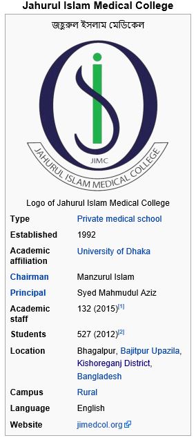
Jahurul Islam Medical College (JIMC) (Bengali: জহুরুল ইসলাম মেডিকেল কলেজ), established in 1992 by Jahurul Islam, is the second oldest private medical school in Bangladesh. Located at the village of Bhagalpur, in Bajitpur Upazila of Kishoreganj District, it is the first medical school situated in a rural area of the country. It is affiliated with University of Dhaka as a constituent college.

Historical Discuss Of Shahid Syed Nazrul Islam Medical College

Shahid Syed Nazrul Islam Medical College (Bengali: শহীদ সৈয়দ নজরুল ইসলাম মেডিকেল কলেজ) is a government medical school in Bangladesh, established in 2011. It is located at Kishoreganj. The college is affiliated with University of Dhaka as a constituent college.
It offers 5 years MBBS degree programme and admits 52 students every year.

History

Shahid Syed Nazrul Islam Medical College was established in 2011. It was named after Syed Nazrul Islam, the first acting President of Bangladesh.
In the year 2010-2011, Bangladesh government approved to establish 4 medical colleges at Jessore, Satkhira, Kishoreganj and Kushtia with a view to improve the healthcare services in the country. Executive Committee of the National Economic Council (ECNEC) endorsed the project. An estimated cost of Tk 5.45 billion was approved as budget to establish Shahid Syed Nazrul Islam Medical College. The project included construction of six storied hospital building, five storied college for academic building, nurses training center, students hostel, internee doctors' hostel, doctors' dormitory, staff nurses' dormitory, mosque, auditorium, principal and directors' residential buildings, installation of gymnasium, procurement of equipment, one micro-bus, two ambulances and furniture with the fund.

Description Of Jahurul Islam Medical College and Hospital

Jahurul Islam Medical College (JIMC) (Bengali: জহুরুল ইসলাম মেডিকেল কলেজ), established in 1992 by Jahurul Islam, is the second oldest private medical school in Bangladesh. Located at the village of Bhagalpur, in Bajitpur Upazila of Kishoreganj District, it is the first medical school situated in a rural area of the country. It is affiliated with University of Dhaka as a constituent college.
It offers a five-year course of study leading to a Bachelor of Medicine, Bachelor of Surgery (MBBS) degree. A one-year internship after graduation is compulsory for all graduates. The degree is recognised by the Bangladesh Medical and Dental Council.

History

Industrialist and philanthropist Jahurul Islam set up, through the Aftab–Rahima Welfare Trust, several healthcare organizations in his home village of Bhagalpur. The first two, in 1989, were what was initially a 250-bed hospital that would become Jahurul Islam Medical College Hospital, and Jahurul Islam Nursing Training Institute. Jahurul Islam Medical College followed in 1992.

Campus


The college is located in the village of Bhagalpur, in Bajitpur Upazila of Kishoreganj District, about 500 metres (1,600 ft) from Bajitpur Railway Station. It is the first medical school in Bangladesh situated in a rural area. Within the self-contained campus, arranged among gardens around an S-shaped lake, are an academic building, separate hostels for men and women, staff quarters, and Jahurul Islam Medical College Hospital, the college's 390-bed teaching hospital. The final phase of hospital construction will expand capacity to 500 beds.
Jahurul Islam Nursing Training Institute shares the campus. It is approved by the Bangladesh Nursing Council and the Directorate of Nurses Services (DNS).

Organization and administration

The college is affiliated with Dhaka University as a constituent college. The chairman of the college is Manzurul Islam. The principal is Syed Mahmudul Aziz.

Academics

The college offers a five-year course of study, approved by the Bangladesh Medical and Dental Council (BMDC), leading to a Bachelor of Medicine, Bachelor of Surgery (MBBS) degree from Dhaka University. After passing the final professional examination, there is a compulsory one-year internship. The internship is a prerequisite for obtaining registration from the BMDC to practice medicine. The academic calendar runs from January through December. In October 2014, the Ministry of Health and Family Welfare capped admission and tuition fees at private medical colleges at 1,990,000 Bangladeshi taka (US$25,750 as of 2014) total for their five-year courses.
Admission for Bangladeshis to the MBBS programme at all medical colleges in Bangladesh (government and private) is conducted centrally by the Directorate General of Health Services (DGHS). It administers a written multiple choice question exam simultaneously throughout the country. Candidates are admitted based primarily on their score on this test, although grades at Secondary School Certificate (SSC) and Higher Secondary School Certificate (HSC) level also play a part. 25% of seats are reserved for foreign students. Admission for foreign students is based on their SSC and HSC grades. Most foreign students who attend are Indian nationals or Nepalis. As of July 2014, the college is allowed to admit 100 students annually.

Third-level Administrative Division,Kishoreganj Town

Kishoreganj (Town) located at 24.4358442N 90.7724762E degree, consists of 9 wards and 56 mahallas. Kishoreganj municipality was established in 1869. The area of the town is 19.57 sq km. It has a population of 77165; male 52.51%, female 47.49%. The density of population is 3943 per sq km. Literacy rate among the town people is 59%. It has two dakbungalows.
As of 1991 Bangladesh census, population 2525221; male 50.29%, female 49.71%; Muslim 92.1%, Hindu 7.2% and others 0.7%.

Religious institutions: Mosque 1035, temple 138.

Literacy and educational institutions: Average literacy 21.94%; male 26.94% and female 16.64%. Educational institutions: medical college 1, nursing training institute 1, university (under construction) 1, college 25, collegiate high school 4, high and junior high school 201, madrasa 120, technical training institute 2, government primary school 808, non-government primary school 1137, kindergarten 16. Noted old educational institutions: Kishoreganj Boy's High School (1881), Hafez Abdur Razzaque Pilot High School, Bajitpur (1890), Jangalbari High School (1862), Mangalbaria Madrasa, Pakundia (1872), Hossainpur High School (1890), Agarpur Gokulchandra High School, Kuliarchar (1907), Kodalia High School, Pakundia (1910), Achmita George Institute (1920), Banagram High School, Katiadi (1912), Azimuddin High School, Kishoreganj (1916).

Cultural organisations: Club 240, cinema hall 23, literacy society 14, press club 1, theatre group 17, public libarary 10, women's organisation17, playground 53, theatre group 4, shishu academy 1, shilpakala academy 1.

Main occupations: Agriculture 45.48%, fishing 1.87%, agricultural labourer 21.02%, wage labourer 3.29%, commerce 11.2%, transport 2.06%, service 4.47%, others 10.61%.

Land use: Total cultivable land 187975.31 hectares, fallow land 5186.56 hectares; single crop 46.74%, double crop 39.44% and treble crop land 13.82%; land under irrigation 59.06%.

Land control: Among the peasants 16.19% are landless, 13.35% marginal, 29.42% small, 18.94% intermediate and 22.10% rich.

Main crops: Paddy, jute, wheat, mustard seed, pulse, potato, peanut, corn, sugarcane and vegetables.

Communication facilities Roads: pucca 280 km, semi pucca 210 km and mud road 5043.50; railways 57 km.

Manufactories Kalia Chapra Sugar Mill (extinct), Kishoreganj Sugar Mill (extinct), Joshodal Textile Mills, Jeminee Textile Mills, Badam Tail Mills (extinct), Aftaf Feed Mills Ltd are noted.

Cottage industries: Chess (Austagram), cane and bamboo work, iron work, wood work, etc. Maslin (Bajitpur, Jangalbari), oyster pearl (Bajitpur Astagram), paper Betal-Tatarkandi, Katiadi, Kuliarchar), tusk goods (Boulai, Kishoreganj), Shital Pati (Austagram), conch goods, etc.

NGO activities Operationally important NGOs are Care, brac, proshika, Popy, Global Village, ARA, Pallibikash.

Health centres Hospital 6, upazila health complex 13, subhealth centre 17, TB clinic 1, maternity centre 3, family welfare centre 61.
Nearby cities: Shahbazpur Town, Agartala, Dhaka City
Coordinates:   24°26'12"N   90°46'52"E

President Abdul Hamid Funny Speech - Azim Uddin High School Kishoregonj. 2016


Austagram view


Parliament Members picture for more infomation in Kishoreganj


Beggger Kishoreganj Documentation July 2015


Funny Bangla song ft Kishoreganj

Funny Bangla song ft Kishoreganj বল খেলাডা তউবা কইরা ছাড় (ব্যাপক বিনোদন )
ফারভেইচ্চ্যারে

Funny Bangla Natok Dialogue by Kishoreganj Language Part 1 | Projuktimona


Magnificant Island of Itna, Kishorgonj

'Magnificent Island of Itna, Kishorgonj'
We're proud to be part of it. Hope you will like it.
To appreciate this untold story of the beauty of Bangladesh, please share.

Client: Itna group
Agency: CSR Axis
Director & Cinematographer: DH Lovelu
Executive Producer: Tamanna Reza Sangita
Production House: Cinematize Pictures

Head of Operations:Adel Wahid
Edit & Grading: Rashaduzzaman Shohag
Art Director: Rafi Al Amin
Music: Mohammad Apple Mahmud Amil

Drone: Ibrahim Quayum Roxy
Sound: Shoibo (Audio People)
Gaffer: Hiron
Focus: Md Rubel
Thankfulness: Rashed Zaman & Sandbag

Allama Farid Uddin Masoud in Kishoreganj Solakia Eid Jamat 2014

শোলাকিয়ার ঈদগায় সমবেত সব মানুষকে তাওবা পড়িয়েছেন যুগের দিশারী কিংবদন্তী আলেমেদ্বীন আল্লামা ফরীদ উদ্দীন মাসঊদ।

Saturday, June 18, 2016

Gangatia Jomidar Bari, kishoreganj

Below is the shortest direction to visit the Gangatia Jomidar Bari(গাংগাটিয়া জমিদার বাড়ী).


1) Take a battery driven vehicle from the Bot toli(বটতলী) of Kishoreganj(কিশোরগঞ্জ) town. Its around 20 taka per person. It takes around 25 minutes to reach near Gangatia(গাংগাটিয়া). GPS Coordinate of the tempo stand is (24°26'29.65"N, 90°46'36.86"E). Dropping zone to leave the battery driven vehicle is (24°27'14.96"N, 90°42'8.58"E).


2) You'll find nothing here. So start walking by asking direction to the local people(10/12 minutes of walking). They know this as Manob Babur Bari(মানব বাবুর বাড়ী). GPS Coordinate of the Manob Babur Bari(মানব বাবুর বাড়ী) aka Gangatia Jomidar Bari(গাংগাটিয়া জমিদার বাড়ী) is (24°27'45.63"N, 90°42'11.82"E).


Most of the Hindu Jomidar Bari(জমিদার বাড়ী) from Bangladesh are in a very poor condition. That time the owners were facing difficulties for religious upheaval and other adverse situations, thus they have sensed an urgency to leave this country for their own safety. But fortunately, here they are still living with pride, may be they were too much friendly with the peasants.

Historical Places of Kishoreganj, Bangladesh

Kishoreganj, is a district in central Bangladesh, once called Haybatnogor in the ruins of Mughal era. It was an area in the kingdom of the Kamrupa. Pala, Varman & Sena kings ruled this area or part of it during 11th & 12th century. After their demise, few petty independent kingdoms arose under the Koch, Hajong, Garo and Rajbanshi. During 1491 AD the greater part of Mymensingh was included within the Muslim rule under Firoz Shah, Kishoreganj remained outside. During the reign of the Mughal Emperor Akbar, some of the major parts was included in the Mughal Empire including Jangalbari and Egarosindur remained under the Ahom and Koch kings. In 1538 AD, Mughals conquered Egarasindhur by defeating the Ahom king and in 1580, Isa Khan defeated the Koch Chief of Jangalbari. The episode of the conflict between the Mughal Commander Man Singh and Isa Khan, the Chief of the Bara-Bhuiyans (twelve landlords) in 1580, defeated Man Singh, after the death of Isa Khan in 1599. Kishoreganj was under the rule of his son Musa khan, ultimately seceded to the Mughals.

Note: For the details of each location on the clip, please click on the "Subtitles and CC". This is not a Documentary, shared for the common Interests.

Interesting places:

01.Egaroshindoor: a village situated on the east side of the river Brahmaputra.
02.Sadi Masque: built in 1062 AH (1652 AD) by one Sadi, Son of Shaikh Shiroo during the reign of Emperor Shahjahan.
03. Shah Mahmud Mosque: built in 1680 AD at Egaroshindoor.
04. An Old Shiva Temple: built in 16th Century (1486-1533) on the ruins of Gauḍa.
05. Shiva Temple: located on the entrance of the Gangutia Zaminder Bari (House)
06.Gangutia Zaminder Bari (House) : Located at Gangutia Union, Hossainpur Upazila
07. Shiva Temples at Poet Chandrabati Village: Two Shiva Temples located at the Chandrabati village in Neelgonj.
08. Poet Chandrabati’s Home : Resident of The first Female Poet in Bengali Literature, located at the Chandrabati village adjacent to the Shiva Temples.
09. Isa Kha’s Jangalbari Fort: The remain fort is still visible
10. Haybatnogor Zaminder Bari Masque: located adjacent to the Jangalbari.

Clip Info: taken the moment with “Save the Heritages of Bangladesh” (A social media based group).

The Some Picture Of Kishoreganj District